Blank world map
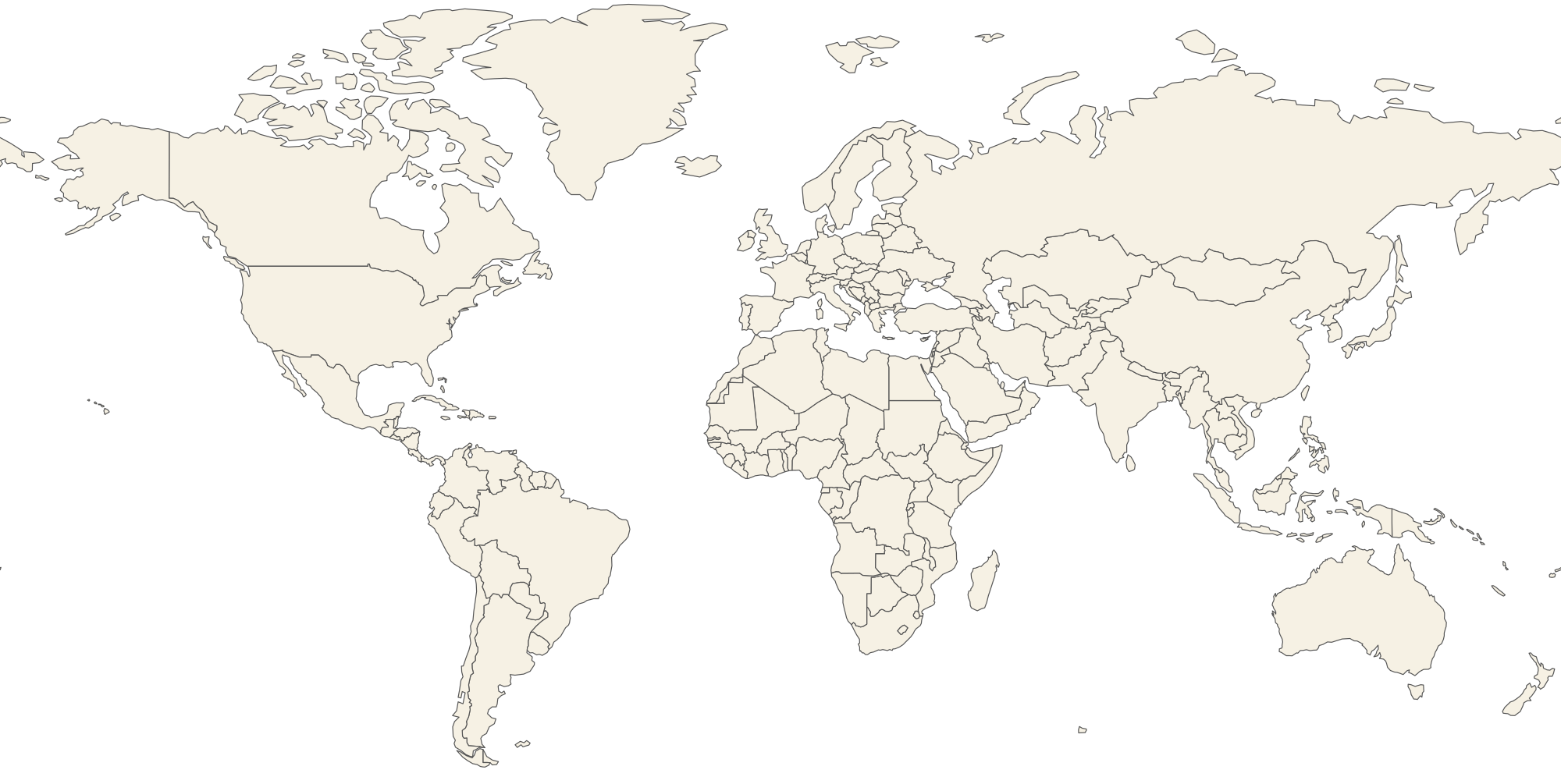
A free blank world map with every country outlined, ready to explore on screen, print for class or download as a vector file. Hover or tap a country to see its name, or switch names on to check your answers.
How to use this blank world map
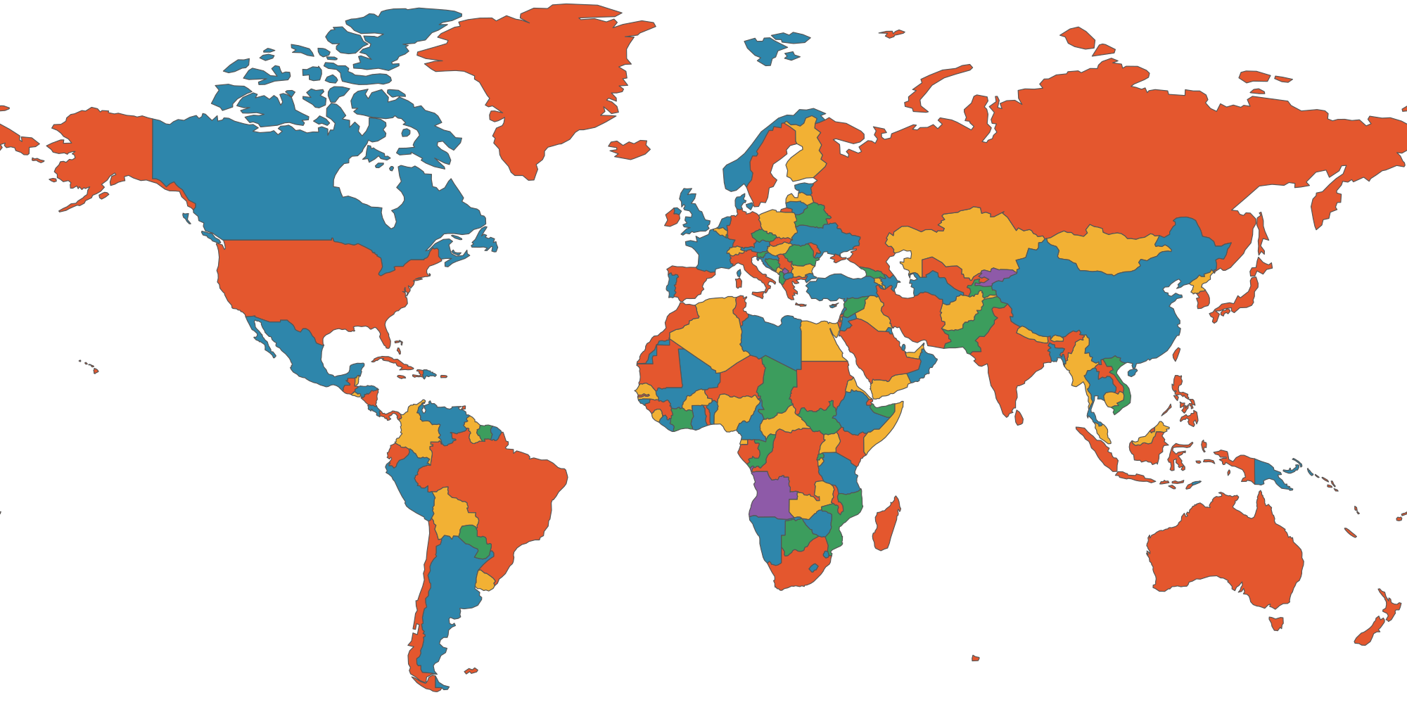
Use it as a study sheet: print it, name as many countries as you can, then turn on the names to check. Teachers can print one per student for geography lessons, and parents can use it for homework and quiz nights. The coloured version shades neighbouring countries differently so borders are easy to see.
The SVG downloads are vector files, so they stay sharp at any size and can be opened in design software, Google Slides, PowerPoint or a browser. They contain country borders only, with no labels, so you can add your own.
What the map shows
The map has 176 countries and territories drawn from Natural Earth data, which is in the public domain. It uses the Miller projection, which keeps familiar shapes while limiting the stretching near the poles. Antarctica is left out, and very small islands are too small to draw at this level of detail.
Ways to use a blank world map
- Geography quiz: hide the names, point to a country and say it out loud, or print the map and fill it in with a pencil. Start with your own continent, then add one more each week.
- Classroom activity: colour each continent a different colour, mark the equator and the tropics, then add the capitals or the places you are studying.
- Travel map: shade the countries you have visited and plan the ones you want to see next.
- Reports and presentations: download the SVG, drop it into a slide and highlight the countries your topic is about, such as trade routes, languages or festivals.
- Sports, news and business: mark where teams, events, offices or customers are.
Learning the world in steps
Nobody learns 190 countries at once. A common approach is to go continent by continent. Start with North America and South America, then Europe, then Africa, then Asia and Oceania. Within each continent, learn the largest countries first because they make good landmarks, then fill in the countries around them. Use the colour option to see where one country ends and the next begins, then turn it off and test yourself.
Blank map or labelled map?
A labelled map is best for looking things up. A blank map is best for remembering. Writing a name yourself, or recalling it before you check, is a far stronger way to learn than reading it. That is why this page lets you switch names on and off.
Printing tips
Choose landscape orientation and “fit to page” for the best result. Use the Print button, which prints only the map. For a poster, download the SVG and print it from a design program or at a print shop; because it is a vector file it stays sharp at any size. The plain version uses very little ink, and the coloured version looks better on a classroom wall.
Continents at a glance
There are seven continents by the most common convention: Africa, Antarctica, Asia, Europe, North America, Oceania (Australia and the Pacific islands) and South America. Antarctica has no countries, so it is not drawn here. Russia and Turkey each span two continents, and Egypt reaches into Asia through the Sinai peninsula, which is why continent maps sometimes disagree with each other.
Want more than outlines? The interactive atlas has 656 pins for people, history, architecture, festivals and crafts, and the country pages list leaders and famous people.
Frequently asked questions
Is this blank world map free to print?
Yes. You may print it for personal, classroom and non-commercial use. Please keep the link back to this page if you share it online.
Can I download a blank world map as a file?
Yes. Use Download SVG for an outline map, or Coloured SVG for one with neighbouring countries in different colours.
Which countries are included?
176 countries and territories at 1:110m detail. Tiny states and small islands may not be visible at this scale.
Can I label the countries myself?
Yes. The SVG has no text, so you can open it in any drawing program and add your own labels.
Which map projection is used?
The Miller cylindrical projection, a gentle variation of Mercator that makes high-latitude countries look less oversized.
Does it show disputed borders?
It shows the borders in the Natural Earth data. The atlas takes no position on disputed territories.
How can I test myself?
Print the map or hide the names, then try to name each country. Turn on Show names to check.
How many countries are there in the world?
There are 193 member states of the United Nations, plus a few others such as Vatican City and Palestine that are not full members. The exact number depends on who is counting.
Why does Greenland look so big?
Flat maps stretch areas near the poles. Greenland is about the size of Mexico, even though it can look as large as Africa on some projections.
Can I use it for school or my website?
Yes for classroom and personal use. If you publish it online, please link back to this page.